1. West End (1A) (MP 56-58)
2. Off Alignment (3-6)
3. East End (1B) (MP 45-47)
4. Juneau Creek Bridge
(Phase 2)
")
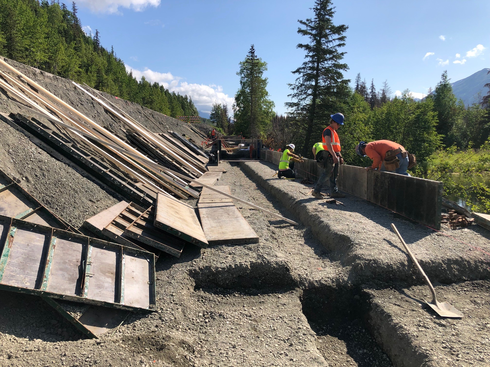
The West end of the project, also called Phase 1A, is located between milepost (MP) 56 and 58.
This section of road has been under construction this summer. One wildlife crossing will be finished this year, and the road should be back to normal for the winter.
Construction of this phase is scheduled to complete in 2022.
Recreation access is being maintained on all trails throughout construction.
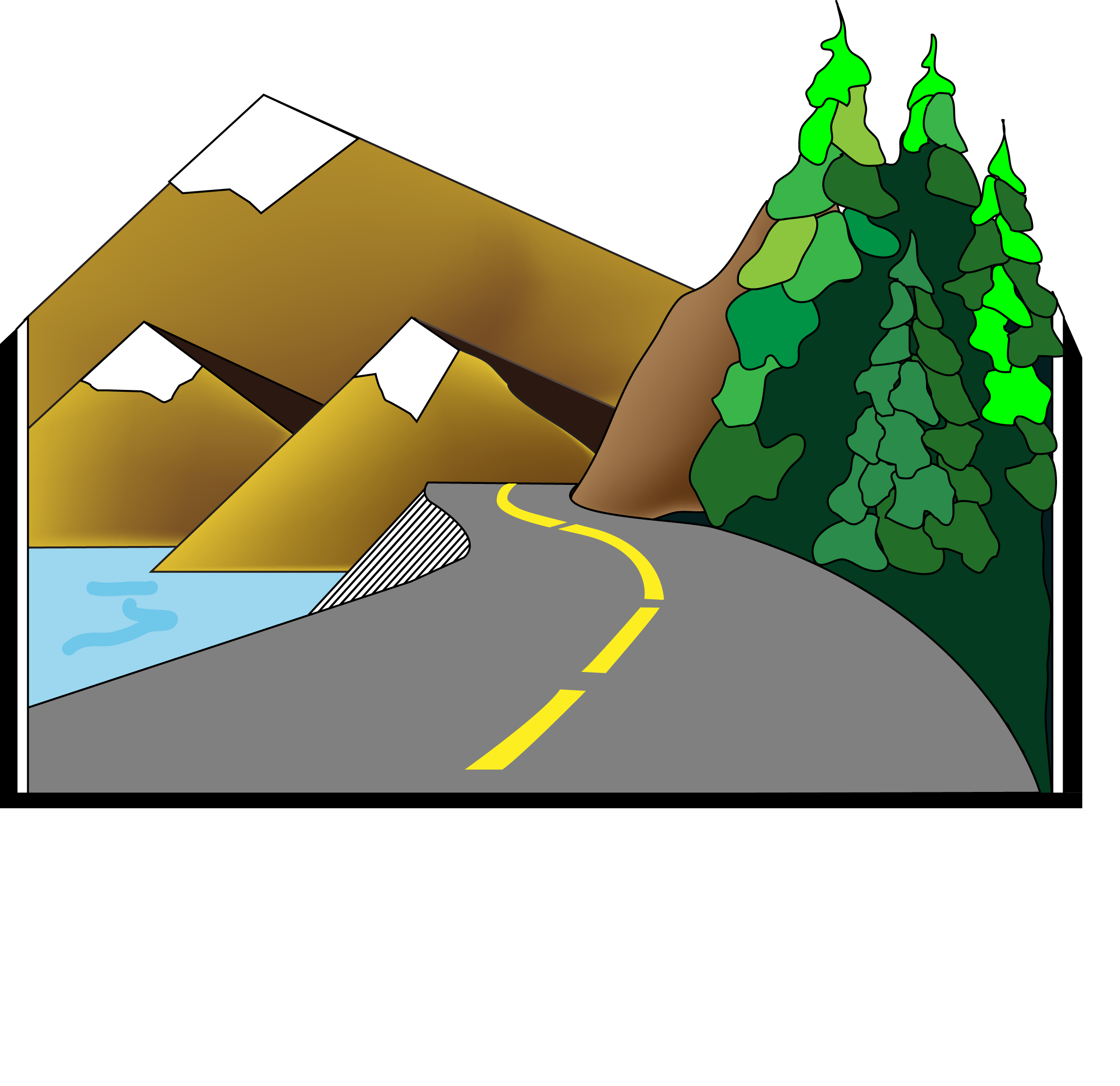
When completed, the road will feature twelve-foot lanes and eight-foot shoulders. Significant features of this phase include wildlife crossings and rock cuts. Mesh retaining walls will blend in with the roadside rock for a natural look.

Mesh retaining walls will blend in with the roadside rock for a natural look.
Bolt Layout
West End (Phase 1A)
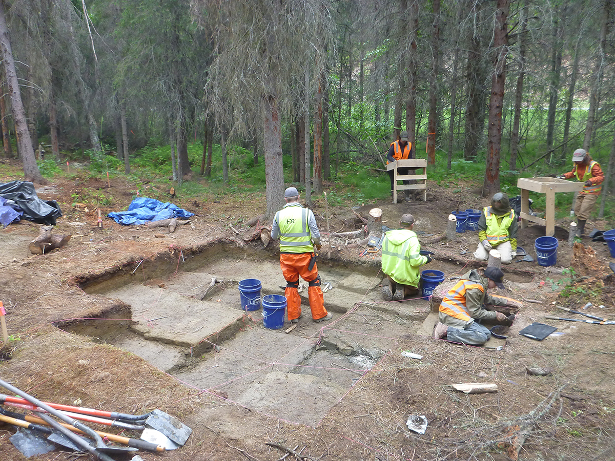
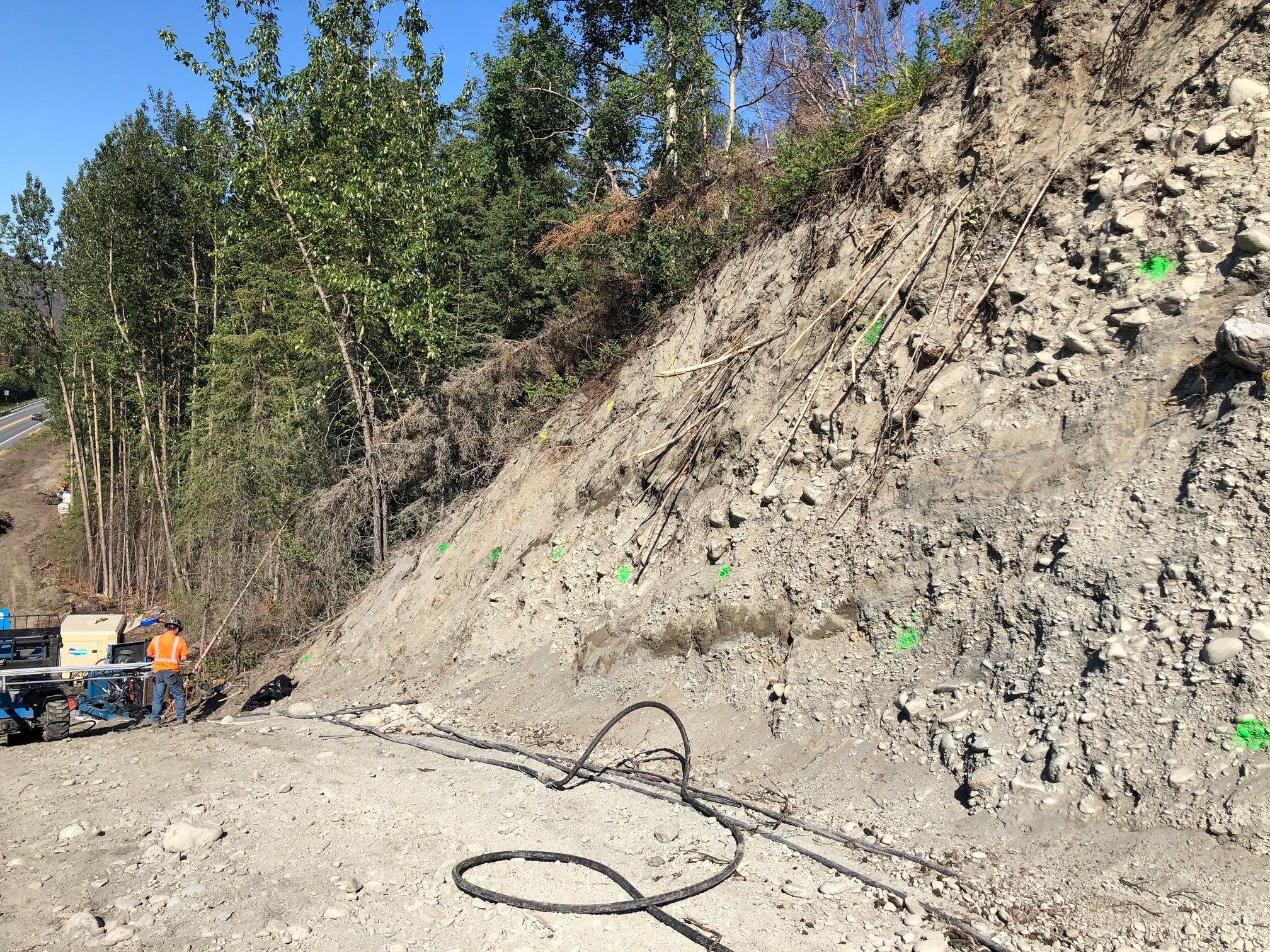
Monitoring for Cultural Resources
Retaining Wall

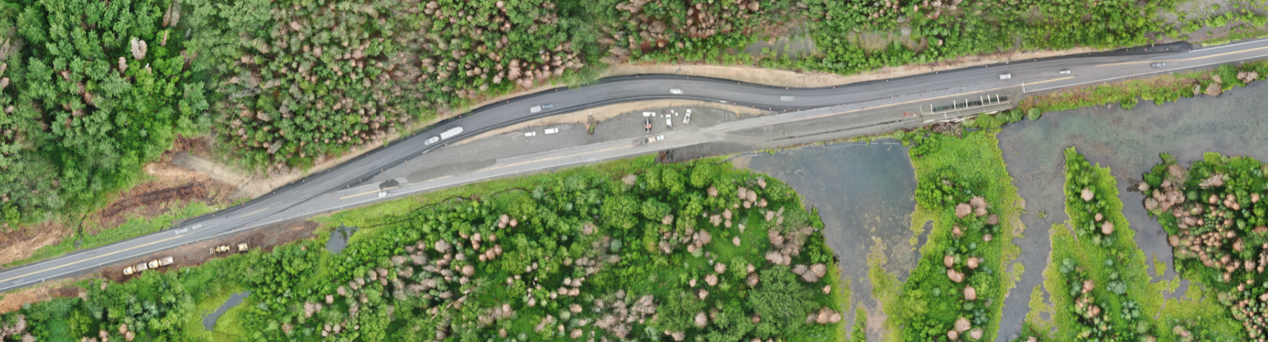
Sterling 1A Construction
1. West End (1A) (MP 56-58)
2. Off Alignment (3-6)
3. East End (1B) (MP 45-47)
4. Juneau Creek Bridge
(Phase 2)

This segment of the project stretches from MP 47 to MP 56 and will build a new section of highway to pull the road away from the Kenai River and to cross Juneau Creek in the best location.
Construction is occurring this season to create access to the bridge.
Highway design is approaching 70% design.
Features include wildlife crossings and climbing lanes which allow for faster vehicles to pass slower ones on the uphill sections of road.
Design continues on the intersection of the new and old Sterling Highways at the west end. The intersection will function like the Girdwood intersection.

PATHWAYS
A pathway along the south side of the new highway has been approved and design is progressing. The pathway was requested by the community. Benefits including creating pedestrian connections to other trails and allowing construction to use excess material on-site instead of hauling it away.


RECREATION
Resurrection Pass Trail
- The trailhead will have new parking and a dedicated left turn lane.
- A new trail will connect from the parking lot to the Resurrection Pass trail. An equestrian access trail is included.
- The parking lot will accommodate the access road and include snow storage areas.
- An overlook will be built where the Resurrection Pass trail and the new trail connect.
- The Resurrection Pass trail will receive minor reconstruction.
Bean Creek Trail
- A new pullout will be built to access the Bean Creek Trail.
- The trail will receive minor reconstruction.
Slaughter Gulch Trail and Creek Crossing
- Hikers will be able to access the Slaughter Gulch trail through a highway undercrossing structure.
- The creek will use the same structure to cross the highway.
1. West End (1A) (MP 56-58)
2. Off Alignment (3-5)
3. East End (1B) (MP 45-47)
4. Juneau Creek Bridge
(Phase 2)

The East end of the project reconstructs the highway alignment between MP 45 and 47. This section is also called Phase 1B.
Extensive rock excavation is needed to move the highway further north away from Kenai Lake and to straighten out the curves.
Just over 1 million cubic yards material will be excavated and placed along other sections of the project. This volume is similar to excavations at the Bird Creek parking lot on the Seward Highway.
Design is finalized for the intersection at the west end of this phase at MP 47. This provides a new connection between Sterling Highway and the current (Old Sterling Highway) as the primary access into Cooper Landing. The intersection will feature:
- A westbound left turn lane from Sterling Highway onto the new connection to Old Sterling;
- An eastbound right turn lane from Sterling Highway to the new connection to Old Sterling;
- An eastbound ramp (to Anchorage) from the new connection that merges on to the Sterling Highway; and
- A westbound, stop controlled, left turn (to Soldotna) from the new connection to the Sterling Highway.
Design for the Quartz Creek Road intersection at MP 44.5 will be available to view in fall 2021.
The pedestrian tube undercrossing trail design is unchanged. It connects the separated pathway on the south side of the highway with the Coyote Notch Trail on the north side.
Other design work includes looking at striping and other ways to increase safety for turning vehicles to access Russian Gap and accounting for development on the Kenai Peninsula Borough (KPB) Tract C.
Utility design is 80% complete. Right-of-way acquisition is underway and is slated for completion in August 2021.
Construction timing on this phase is tied to Phase 3. Construction will likely bid in 2022 and start in 2023.
1. West End (1A)
2. Off Alignment (3-5)
3. East End (1B) (MP 45-47)
4. Juneau Creek Bridge


A steel arch design was selected for the bridge over the Juneau Creek.
Foundations will be constructed a bit lower than we originally anticipated, which will lower the bridge itself, reducing visual and noise impacts.
The bridge features a wildlife crossing separated from traffic.
Due to the length of the bridge and the type of rock at the abutments, a massive geotechnical effort in 2020 and 2021 is gathering data for foundation design.
The bridge is estimated to take three years to build, including steel procurement. The bridge is a critical scheduling factor for the entire project.
1. West End (1A)
2. Off Alignment (3-5)
3. East End (1B) (MP 45-47)
4. Juneau Creek Bridge
A steel arch design was selected for the Bridge over the Juneau Creek.
Foundations will be constructed a bit lower than we originally anticipated, which will lower the bridge itself, reducing visual and noise impacts.
The bridge features a wildlife crossing separated from traffic.
Due to the length of the bridge and the type of rock at the abutments, a massive geotechnical effort in 2020 and 2021 is gathering data for foundation design.
The bridge is estimated to take three years to build, including steel procurement. The bridge is a critical scheduling factor for the entire project.